Tuesday, November 20, 2012

Final passage

We woke on a bright Saturday morning to winds from the south.  Since our course across Lake Ontario was NNE from Oswego, the 10 MPH push from the stern was optimal.  The engine started without a hitch.  We let it idle for a half hour while we put away our breakfast dishes and made ready to get under way.  I confirmed the phone number and hailing channel for the local Tow BoatUS just in case of a severe overheat.  Our planned course would take us on a parallel path to the eastern shore of the lake about 10 miles out.  There are no safe deep harbors that could handle the draft on Broad Reach on that eastern shore, so once we were well out on the lake, we were committed to making Sackets Harbor by sunset.  We followed the breakwater out past the West Pierhead Light and into Lake Ontario.


As we headed out of the harbor, we were not able to see the farther shore to the north.  It would be about three hours of steady motoring before we planned to be able to see the headlands at Stony Point.  I had previously done some salmon fishing off Stony Point and knew that you could see the top of the cooling towers at the Nine Mile Point power station near Oswego from 30 miles away.  At least we would have some visible reference off our stern to mark our progress as the southern shore of the lake disappeared below the horizon of water.


The high winds from the prior two days had put a lot of energy into the lake.  Although the wind was from the south, there was a 3 foot swell coming from the southwest.  Fortunately the period between wave crests was long enough that we did not experience too much roll.  As long as we kept the RPMs on the engine close to 2700 we were able to make steady progress and stay ahead of the swells.

The sun began to warm our backs as we moved north.  We had started the day all bundled in layers and foul weather gear.  We began to relax and peel as the temperature climbed.  We were 3 hours out and about 15 miles north of Oswego when trouble struck again.  Just when it was feeling nice and balmy, the engine went into overheat again.  I pulled the companionway ladder and saw that the main belt driving the alternator and fresh water pump was really sloppy.  It had loosened further from the night before.

We stopped the engine again, but this time there was no possibility of dropping anchor.  Without any headway, the boat turned sideways to the swell and began to roll.  The wind was still steady from the south at 10 MPH so I grabbed a blanket and tied it to the mast spreaders and the deck.  This made a small square sail and caught just enough wind to give us a little steerage.


While Niki tried to keep the bow pointed north and the swells onto the stern, I went below and tried to tighten the belt.  No matter how much raw cooling water our new impeller was pushing, it could not transfer heat out of the engine, unless the fresh water circulating pump was pumping coolant through the heat exchanger.  After bracing myself in the companionway against the roll of the boat, I got the alternator forced further out on its bracket, and tightened the belt that drives the alternator and fresh water pump properly.  We started the engine back up again.

We were over a third of the distance across the lake.  We decided to keep going at a slower speed and RPM.  With our tiny little square sail adding extra push we continued further north.  Around noon we were able to see a darkening edge to the far north horizon.  By 1 PM we knew we were seeing Stony Point and Stony Island.


The Stony Point Lighthouse is no longer operational, but it still stands 40 feet high on the shore just below the headlands.  As we moved up the shore past the headlands and cliffs of the point, we knew we were getting close to home.  As soon as we entered the channel between Stony Island and  Stony Point the swells decreased.  So did the wind and we struck our little square sail experiment.


We started checking off the landmarks that we knew well from our previous years in Upstate.  We passed the camps on Association Island at the head of Henderson Bay.  Once passed Six Town Point and Lime Barrel Shoal, we could see Bass Island.  We struggled to find the red mark at the end of Horse Island in the gathering overcast.  We hoped to make it in before any rain began.

When we could see the grassy slopes of the War of 1812 Battleground, we knew we were just around the corner from Sackets Harbor and our new home for Broad Reach at Navy Point Marina.


When the brick buildings of the old navy Barracks came into view and we could see the masts in the harbor at Barracks Marina we started celebrating.


We made the hard turn to starboard around Navy Point and into the inner harbor at Sackets.  The lights were on at the town common and bandstand.  We felt like they turned them on just for us.  All of our favorite restaurants were still open for business.  We even had a welcoming committee of sorts.  As we pulled into our slip, several large salmon that were schooled up in the marina began leaping out of the water repeatedly.  They thought they were feeding on bait, but we knew they were splashing us home.


We had a lot of fun and faced a lot of challenges in making this trip north with Broad Reach.  Some couples would find it hard just to be confined together on 250 square feet of deck for three weeks.  All the new people we met and the new places we saw were fantastic.  The best part of the trip for me was the daily reliance on each other for our comfort, safety, and peace of mind.  It was a total gas experiencing every moment of this adventure together.  I am blessed daily in my life with the compassion, bravery, wisdom and grace embodied in my friend and partner.  Niki you can captain our boat anywhere you like, as long as we go there together.

    
Peace to you all from Sackets Harbor, NY!  

Hot Times on the Oswego Canal

Friday morning October 12 turned out to be solid drizzle.  The winds of the previous day had all but vanished, but the temperature had dropped significantly.  The Erie canal parallels the Onieda River westbound from the lake for about 1 mile up to Lock 23.  There is a small 3 foot drop at this lock down to the level of the Three Rivers.


The Three Rivers junction gets its name from the confluence of the Onieda River, the Oswego River, and the Seneca River.  From this three point junction, the Erie Canal continues westward with the Seneca towards the Finger Lakes, Rochester, and eventually to where it meets Lake Erie at Buffalo.  We needed to go due north towards Lake Ontario on the Oswego Canal.  

Lock 1 on the Oswego Canal is in the town of Phoenix.  The town name turned out to be prophetic.  We had not experienced any engine problems since we started up the Hudson from Sandy Hook.  But we were about to see those concerns get resurrected.  

There is a cantilever road bridge 10 feet north of the lock in Phoenix.  It has a very low clearance.  The lockmaster told us he thought we could make it under the bridge without him having to stop traffic and raise it up.   Once the lock had emptied its water and the gates were open to the north, he advised us to exit slowly under the bridge.  The bridge slopes downward into the town from port to starboard, so I asked Niki to keep us as close to the port seawall as possible as we exited the lock.  We made it under the bridge safely, but there was a huge pad of water plants and debris crowded up against that port seawall.  The debris got caught on the rudder and we immediately lost most of our steerage.  Worse yet, a lot of the material got sucked up into the raw water intake that keeps the engine cool.  The impeller stopped pumping water and we could smell burning rubber out of the exhaust.

We coasted slowly away from the seawall into the center of the channel.  By putting the prop into reverse several times and backing the boat against the current, we finally cleared the debris off the rudder, and were able to steer effectively again.  We knew we had not completely burned up the rubber impeller, as we could once again see water coming out of the exhaust.  We continued  north through the drizzle up the channel towards Fulton.

About 3 miles north of Phoenix the engine overheat buzzer went off.  We needed to stop the boat to investigate.  Our primary anchor locker at the bow was partially covered over by the bow crutch holding the mast above the deck.  We couldn't access that anchor.  We scrambled to get our secondary anchor out of the stern locker.  We nudged Broad Reach over to the east side of the channel, set anchor, and shut the engine down.  Just as we got the engine cover off the motor, it began to hail small pellets of ice.  We could not see anything in the raw water filter, so we decided that the impeller was partially comprised.  We let the engine cool in the gathering wind and falling ice.  When we restarted the motor, it seemed to run OK as long as we kept the RPMs below normal at around 2200.  This would slow our progress to Oswego, but we were back in motion once again.

The wind began to build as predicted out of the northwest.  This put it directly on our nose.  With a compromised cooling system and lower thrust, we made creeping slow progress north.  Locks 2 and 3 in Fulton presented no problems at all, but we were getting concerned that we might not make it past the last lock in Oswego before nightfall.  The dropping temperatures made it pretty cold at the helm.  Niki commented that at least the hail rolled off our shoes, instead of soaking them through like the drizzle.

There is no Lock 4 on the Oswego.  The original design of the system called for a total of 8 locks, but they were able to alter the design slightly to avoid building number 4.  Rather than renumber the plans, the engineers decided to build the system as originally numbered.  They just left number 4 out of the final numbering scheme.

Lock 5 sits high on an exposed bluff in the town of Minetto.  The winds coming off of Lake Ontario were completely unobstructed as they screamed up the river valley to the bluff.  By the time we lumbered around the corner at Red 122 the gusts were gusting hard against us at something like 30 MPH.  At least the clouds had parted and the precipitation had stopped.  It took us a long time to pull into the lock.  The boat was pushed back and forth whenever the wind was not directly on the nose.  Niki struggled with the wheel to keep us lined up with the seawall as we approached.  We thought that the high winds would stop pushing the boat around once the water was lowered and we were down inside the lock basin.  We were badly mistaken.  The wind actually formed a strong vortex down inside the lock basin.  The boat was twisted away from the wall and we both strained on the lines with all our body weight to keep the boat from turning and crashing the mast into the concrete walls of the lock basin.  When the gates finally opened to release us, we chanced putting the motor up to full power again until we were well clear of the spillway.  It was the only way we could get enough steerage to overcome the force of the wind.  Here is a pic of Lock 5 from the web on a calmer day, when cameras could be safely operated.


Locks 6, 7, and 8 are all in the city of Oswego.  Although the wind was still strong, the surrounding topography and the tall city buildings gave us some shelter from the highest gusts while we navigated our last remaining locks on our journey.  We made it down to the harbor and were finally at the same water level as Lake Ontario.  Here is the view upriver to the south from Lock 8.


We had made arrangements to stay at Oswego Marina.  It is the last marina on the river before heading out into the lake.  We were surprised to find that the fixed docks were several feet above the boat as we pulled into our slip.  The water level on the lake is controlled by dams on the St. Lawrence River.  They normally allow the lake level to drop before winter in order to prevent ice damage on shore from wind driven ice flows.  This year they had lowered it so far down, that in order to leave the boat we had to step up onto the doghouse roof and then up another 3 feet to the dock.  With the winds still pushing the boat around, we had to rig fenders on the top of the deck, to avoid the boat being pushed under the docks!

After dinner, we returned to the boat for some engine maintenance.  We pulled and replaced the impeller.  It showed some small cracks on the fins, but there was no major failure of the rubber.  All of the fins were in place.  We began to think that some debris had made it passed the raw water strainer and into the heat exchanger itself.  The alternator drive belt seemed a little loose, but it was not excessive.


Our hoped for weather window to cross Ontario was promised for the next day.  With fair skies and light winds from the south predicted for the morning, we hoped we could limp the final 36 miles across Lake Ontario and into Sackets Harbor without more overheat problems.  We buttoned up the engine and got some sleep.

Monday, November 19, 2012

Crossing Onieda

We woke Thursday morning to bright blue skies.  The wind had not completely stopped, but it had slowed down a little during the night.  The forecast called for winds 5-10 MPH with gusts up to 15 MPH.  If they held at that level, we thought it was worth trying to cross.


From Sylvan Beach on the east to Brewerton on the west end of the lake is only 22 miles.  Broad Reach can easily do 7 MPH under full power.  On a calm day the crossing should have taken us about 3 1/2 hours.  We left the marina around 8 AM and headed out into the lake.  As we powered out past the breakwater at Sylvan Beach there were a few white caps in the distance, but nothing like the previous evening.  There was however a steady 4 foot swell coming down the lake from the west.  The wind was steady out of the west, and we had to power the boat directly into the wind and waves.  After an hour of pounding into the chop we had only made about 2 miles of progress.  The normal passage across the lake follows the buoys down a centerline from southeast to west.  This avoids all of the shoals and shallow water on the south side of the lake.

By the time we pulled even with Lewis Point, the wind began to get stronger and suddenly changed direction.  It quickly built to a steady 20 MPH and shifted out of the southwest.  The change in direction meant that the tops of the westerly waves were being sheared off at an angle that was coming across our port bow.  The spray was drenching the deck.  We soon were pitching and yawing violently with a motion that rolled the boat from side to side, as well as bow to stern.  The mast stayed firmly secured to the deck, but we were concerned about how much stress the temporary stays could handle.  We talked about turning around to run downwind back to Sylvan Beach, but that would expose us to the same chop from the stern.  We made a decision to navigate past the shoals and towards the southern shore.  If we could get in close enough to the new direction the wind was coming from, we could at least reduce the pitching of the boat.

 As we approached the southern shore, the cross chop got stronger.  We started calling on the VHF to see if any of the marinas on the southern shore had enough depth for us to safely make harbor.  We tried hailing Lakeport Marina, but got no response.  When we were just a few hundred yards off Bushnell Point, the chop lessened a little, and we finally felt we could continue up the lake without shaking the boat and crew past their limits.  There were a few tense minutes of consulting the GPS as we tried to cross just north of Lakeport Shoal, but without going too far back out into the center of the lake.

By the time we made Shackelton Point at noon, we were halfway up the lake.  The decision to hug the southern shore proved to be a good choice.  The winds began to lessen and the chop reduced to  2 feet.  The winds were still out of the southwest but there was not as much fetch for the wind to build a significant cross chop.  We decided to use the two islands in the middle of the west end of the lake as cover.  We reasoned that there should be a wind shadow in the lee to the north of Dunham Island that would protect us from worst of the wind.  The only catch was that the approach to the northeast end of Dunham is guarded by lots of shoal water.  The marked channel between the shoals is only 500 feet wide.  We set a new bearing on the GPS and headed back out into the center of the lake on a NNW heading.  We found the Red Mark 130 just shy of Pancake Shoal.

By the time we had negotiated the narrow channel into the lee of the island, the wind suddenly died.  It was 2 PM when found some breathing space.  By the time we had passed Dunham and Frenchman Islands, we were finally able to get the camera out for a photo.  The temporary stays had done their job, and the rig had been fully proven.  The chop we had been fighting all day was gone.


We were exhausted and ready to be off the lake when we saw the bridge for Interstate 81 in the distance.  We knew we had made it to Brewerton.  It only took us 7 1/2 hours of pounding to make it there.  As we swung under the bridge, the winds that we had fought all day died out completely to a flat calm.  Timing is everything.


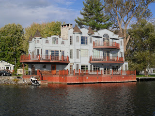
As we made the turn onto the Erie canal again, we saw this unique waterfront home.  We both wished we had spent the day lounging on their sundeck.


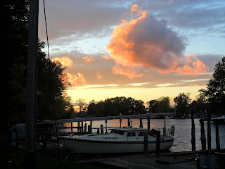
Pulling up to the dock at Brewerton Boat Yard we both decided that we needed some scotch and warm food in that order.  The Waterfront Tavern gave us a great view of where we had just been. It was astounding to see how flat the water on the lake was as the sunset turned the water a golden yellow.


The forecast for the next day was for more wind and rain, with the temperature falling into the 40s.   
Predicted winds were 20 MPH with gusts above 40 MPH.  How difficult could that be down in the protected valley through which the narrow little Oswego River runs?  Nothing like the day we had just gone through.....we hoped.

Ilion to Oneida Lake

We were paying particular attention to the weather forecasts Wednesday morning as we got closer to Lake Ontario.  We needed a weather window of fair skies and low winds to make the crossing from Oswego to Sackets Harbor.  Ontario is like a huge inland sea and wave states can quickly build to challenging levels.  When we listened to the morning report on the VHF, the prediction was for high winds and rain for the next few days.  There was a chance that the upcoming Saturday October 13 could give us the weather we needed.  Niki needed to report for work on October 15, so we decided to press on as fast as we could up the canal to Oswego.

All of the little villages and towns along the Erie had done what they could to make their hamlets inviting and accessible to boaters.  We were amazed that the city of Utica did not have any real facilities along its shore.  The view from the canal was very industrial.  We passed one restaurant that had a dock for canal traffic, but it was all closed up.  We did see this pretty tiny waterfall right in the heart of the city on the north shore.


Lock 20 would be our highest point on the journey at 421 feet above sea level.  It is located just outside the village of Marcy.  Up until this point, we had been fighting the turbulence inside the lock basins as they filled rapidly with water to lift the boat.  Once through this lock we would begin to ride the more gentle down elevator toward the lower level of Lake Ontario.  The lock is situated inside a grove of evergreens.  As Niki steered us from the spillway into the basin, there appeared to be a short thick log floating across our bow from starboard to port, between the open lock gates in the middle of the channel.  As we got closer to the gates, the log suddenly reversed direction and floated back to starboard.  When we came alongside it we could see that it was a large beaver loitering just outside the lock.  He was not at all intimidated by us as we coasted past into the lock.   His slow cruise past the boat gave us a great view through the water at his fully stretched  body and big fat paddle of a tail.


The city of Rome has spent some money for a small park and a long seawall for boaters to tie up.  Here is a shot of that area from the web.


Just beyond the west end of this park the Mohawk River spills down into the canal from the center of the city.


We passed a number of state work boats on this stretch of the canal.  One small tug was pushing a barge full of tree stumps up front while towing a barge full of dredge pipes behind.  All afternoon the wind and clouds began to fill in.  The predicted weather front was moving in.  The downhill rides in Locks 21 and 22 were as smooth as could be.  The water drains out from the bottom of the lock basin when locking down, so the only turbulence created is outside in the spillway.  It was a different view pulling into to a lock of water and looking over the edge of the gates to the lower countryside beyond.

A few miles past Lock 22 we turned the corner into Verona Beach.  We could see beyond the canal past the breakwater and out into Onieda Lake.  The wind was bowing a steady 20 MPH with gusts up to 35 MPH.  Whitecaps were visible far out to the horizon.  We decided to stay at Holmes Marina, which sits back in a deep pocket behind a large grove of trees.  The trees shielded us from all but the highest gusts of wind.


We walked into town and crossed over the last few feet of the canal on the Highway 13 bridge into Sylvan Beach.  We had to hold onto our hats to keep them from blowing away in the unprotected winds coming straight off the lake.  Sylvan Beach is an amusement park town on the eastern shore of Onieda.  It felt more like a ghost town to us.  All the rides were shut down for the winter.  The wind was whipping sand off the beach and making small dunes in the middle of the street.  The only thing missing was a few tumbleweeds.  

As we walked back across the bridge, it felt like rain was starting to come down.  It turned out to be a different kind of water falling from the sky. The wind was whipping so strongly across those whitecaps out on the lake, that it was lifting water off the lake, up into the air, and onto us.  All through our early dinner at the Spaghetti Factory, we kept talking about the high winds and wondering if it would calm down enough by morning for us to attempt the 20 mile crossing of the lake tomorrow.  We decided to turn in early, and if the winds and chop abated, to try for an early morning crossing of Oneida Lake.  

Sunday, November 18, 2012

Canajoharie to Ilion

The guy in the boat tied up next to ours at the water park in Canajoharie told us there was a marina above the next lock where we could buy some diesel.  We left early Tuesday morning to continue down the canal due west.  The marina at St. Johnsville was a deeply dredged anchorage on the north shore.  The fuel pump was directly on a high concrete seawall above the canal.  While I was filling the jerry cans we keep for backup with diesel, Niki went walking around the campground and municipal marina.  She liked this little lighthouse.


Our son Will loves classic muscle cars.  Niki saw this reworked truck with headers and suggested it could belong to him.  The licence plate was appropriate.  These are for you Will!


Above Lock 16 the Erie leaves the bed of the Mohawk River for the first time.  The canal parallels the river on the south side at a higher elevation.  We passed under several guard gates that protect the canal channel from high water when the river is in flood stage.  They must work fairly well, as we saw no obvious flood damage on this stretch of the canal.

Lock 17 at Little Falls is the highest vertical rise that we would encounter on our trip north.  It raises the water level all of 41 feet.  We were getting pretty used to locking through by our third day on the canal, but this lock presented some unique challenges for us.  All the the previous locks had been of the same design, with horizontal swinging gates port and starboard at the bottom of the lock basin and another pair of matching horizontal swinging gates at the top.  When we turned the corner to view Lock 17, we saw a huge four sided concrete tub with a single vertical lift gate.


You actually drive the boat under this massive steel door.  The two buildings visible on top of the lock wall house the motors and cables that lift the door up.  Once you are in the lock, they drop the single door straight down past the concrete wall to seal you in.


As we were waiting in the spillway for the green light to signal that we were free to enter the lock, a 50 foot powerboat came rushing up behind us.  We hailed him on Channel 13 and asked him to slow down and give us a little more space.  Yes, you can also be a tailgater on the water.  We were already in the no passing area of the lock spillway, but the captain asked us if he could enter first.  We said sure, thinking we would rather have this rude person in front where we watch him, and asked if he would pass us slowly on the port side.  He ran right in and his mate grabbed the second line on the port side lockwall.  We came in behind and grabbed the single first line that he had left for us.  The captain of the 50 footer must have turned off his radio upon entering the lock, because the lockmaster kept trying to hail him on 13.  The lockmaster was asking him to move forward in the lock to the next set of lines so that the sailboat behind him could grab two lines.  No response from the captain of the power boat.  His single deckhand was holding onto that second line while the captain was trying to maintain his position against the wall with bow and stern thrusters.  Finally, the lockmaster leaned over the top of the lock and gave several sharp whistles.  The captain looked up, and finally got the message, put his twin screws in gear, and moved forward a little.  After we were able to secure Broad Reach with two lines, the lockmaster was satisfied, and began to fill the lock.  We were very happy to see the 50 footer hit the gas and speed on up the canal once the lock was opened.

There is another town park and free marina in Little Falls just above the lock.  It looks like they took the old railway station and converted it into a tourist center and park.  We made a promise to each other to come back there for a stay someday.


Just above the marina, we were treated to a spectacular spectacle in the sky overhead.  I wish we had a telephoto, because we were not able to get a good pic of the pair of American bald eagles that were circling above us.  It must have been a mated pair.  One bird made lazy circles high above the marina and lock, while the second bird followed our path to the west.  After a few brief moments it became clear why the second eagle had diverted in our direction.  He was chasing after another smaller raptor that was crossing his territory to the west.  For the next ten minutes we watched what could only be described as an aerial dogfight.  The smaller bird had sharply pointed wings like a falcon and very quick reflexes.  The eagle had a massive advantage in wingspan and power.  He quickly closed the gap on the tail of the smaller bird.  Each time he got close to the falcon, the falcon would turn sharply away and try to gain altitude by wildly flapping his smaller wings.  The falcon tried to evade being caught in the eagles talons by flying higher and tighter circles than the eagle.  Every time that the falcon stopped circling and made a straight run away, the eagle was able to turn on the power of his greater wingspan, and the eagle was able to close the gap.  The eagle made several midair grabs at the smaller bird.  The circles got tighter and tighter.  The smaller bird seemed to be tiring.  It seemed inevitable that the eagle would catch the falcon, but then suddenly and inexplicably the eagle turned back to the east toward his mate.  We thought the show was over, as the falcon circled higher above the eagle, but to our amazement after only a few quick circles for altitude the smaller bird folded his wings and swooped down on the eagle from directly above.  The eagle must have caught a glimpse of the motion overhead, because he rolled onto his back just in time to parry the blow from the stooping falcon with his talons.  The two birds finally disengaged, and flew off in separate directions.  It was an amazing sight.

We kept talking about the eagles and what we had seen for the next few miles.  At Buoy 510 is the old Herkimer homestead and fort.  This settlement dates back to the early settlement of the Mohawk River valley in colonial days.  We had a good view of the old cemetery and the historic buildings beyond.  The sights became more bucolic as we made our way west.  There were lots of farmsteads framed by rolling hills dressed in fall colors.


We were surprised that the city of Herkimer did not have much for dockage along the canal.  There were a few restaurants on the waterfront, but nowhere for overnight, so we continued on towards the town of Ilion.


Just before the bridge that connects Ilion to the NY State Thruway on the south side of the canal is the town marina.  It has a small campground and marina.  The marina is full service and the staff were very friendly.  While we were doing laundry, a local police cruiser pulled into the parking lot.  I asked if there was some trouble going on, and was advised no, that all the town vehicles were helping to deplete the supply of gas and diesel in the marina underground storage tanks.  At the end of boating season, the police, the highway department, and even the fire trucks line up for fuel at this little marina.


After laundry, we walked into town for supper.  We ducked into Sorrento's Italian restaurant on Central Ave.  While we were looking at the menu, we noticed that the place was owned and run by the Magro family.  Turns out that they are cousins to the same Sicilian Magros that run Stefanos Pizza in Carthage, our regular fix for all foods Italian near home in upstate!  We enjoyed our small world factor dinner and had a leisurely stroll back down to the boat for some sleep.

Friday, November 9, 2012

Schenectady to Canajoharie


Just north of Lock 7 the Mohawk River does a grand loop to the north and then back south around the city of Schenectady.  The canal affords a good view of the General Electric plants.  GE was formed in this upstate city in 1892 and the original plant still operates there today.  It was one of the original 12 companies that formed the DJIA when that index was created in 1896.  It is now the third largest firm in the world globally.  Innovations in green tech put it at 63rd in the nation in Newsweek's ranking of green companies.  Apart from the 30 years that their plants near Lake Champlain spent pumping PCBs into the Hudson, and apart from the recent headlines regarding the Fukushima nuclear plants design, you rarely see negatives about this company in the news.  For a company so large and so diverse, they have a pretty good track record.  With over 100 years of sustained operations, you would also have to call them a model for successful corporate capitalism.  But even with a greener giant in the neighborhood, and with the local economy buoyed by this huge corporate citizen, the local headline on Monday morning was that fully 50 percent of the city's children live in households below the poverty line.  GE has been very good for Schenectady, but apparently not good enough for a lot of its citizens.

We passed some pretty little waterfalls created by the outfall from the GE Knolls Atomic Power Lab.  The parking lot was full at the GE Research and Development Facility.  The Mohawk Park Marina and Wells Seaplane Base had more RVs in the yard than boats, and not an airplane in sight.  Things appeared to be booming at the GE Renewable Energy plant.  Let's hope they keep shipping those containers of product to India and beyond.

We saw more evidence that NYS was investing in canal infrastructure.  The old damaged bridge pictured here was being dismantled and rebuilt so that us boaters could continue to enjoy the Erie.


We were happy to see that NY supports recycling on these projects.  Instead of dumping the steel into the river bottom, this barge was slated to headed back down to that big stack of steel we saw outside of Albany.


Flights of black ducks were crowding the shoreline.  This was the first time we had seen this species in large numbers.


We began to notice a lot of suds and foam below the dams on the canal.  It did not seem to faze these geese at all.


We came up on Lock 12 and curiously noticed that a middle 40 foot section of the north seawall was missing.  After the filling water lifted us up to the top of the lock, the lockmaster advised us that the seawall was not missing.  They knew exactly where it was.  The overflow from the recent floods had scoured a 65 foot deep hole in the bank behind the seawall, and deposited all that concrete directly into the depression at the bottom.

Lock 13 presented some special challenges with current, which prevented us from getting photos of the approach to the lock.  Here is a before photo off the web.


In order to repair storm damage, the entire right side of the bridge had been surrounded by a cofferdam diverting the flow to the left.  The gates on the left side of the bridge closest to the lock entrance were shutdown completely except for the one lone wide open gate alongside of the lock wall.  All the overflow of the river was being directed through this one gate.  This created a very strong current with a tremendous ebb into the lock entrance.  Niki did a really superior job of getting the boat lined up and into the lock while working the helm back and forth at a frantic pace.  We covered our ears as best we could, to shield out the huge noise of the pumps working to keep the coffer workspace dry, while we were lifted up to the next level.  We were very glad to leave this job site behind us.

We had heard that there was a nice public marina at Canajoharie.  We were very pleasantly surprised when we turned the corner at Green Buoy 357 to see a brand new park and new docks on the south side of the river.  The town provides free dockage and shorepower to boaters.


If you drive the NY State Thruway from Syracuse to Albany you cannot help seeing the huge chewing gum and baby food plant alongside the canal and freeway here.  We have passed this little hamlet hundreds of times, but never took the opportunity to explore it.


As we walked into town to find dinner, we walked past the front entrance to the plant.  The parking lot was empty, all was quiet, and there was a For Sale sign at the main walkway.  A lot of the store fronts in downtown were also empty or closed.  Fortunately for us, Jim's Irish Pub showed an "Open" sign in the window.  The place had two local feelin-no-pain patrons at the bar and one German born barmaid at the tap.  They told us that after 118 years in this town, Beech-Nut had decided to relocate to a new plant 20 miles away.  Some of the local workers were able to make the transfer, but the major revenue source for the local economy had left the town for good last year.  Despite this hardship, the locals were upbeat and hopeful.  I laughed until my belly hurt at many of the stories and opinions leveled at us non-stop from bar stool number 2.  The Guinness was even better than the food, and the stories got better with more Guinness.  It was a great night.  Besides the web lists this bar as a great place to go if you are spoiling for a fist fight, and who can resist a good old fashion Irish bar fight? "May the good Lord take a likin to you, but not too soon!"

Sunday, November 4, 2012

Entering the Erie Canal

The Troy Motor Boat and Canoe Club has been in existence since 1911.  The club is a "working" club where members pay a fee and commit to over 50 hours of service to the organization annually.  
We happened to be there to see their special hands on approach to boating.  The club is located a few blocks away from a large shopping center.  We got up early on Sunday morning, had breakfast aboard, took showers at the clubhouse, and then headed up town to buy some more provisions for the trip.  When we got back to the boat, the club members were down on the dock in force, and were bringing boats out of the water for winter storage on the clubs unique marine rail system.


The clubhouse and yard sit up on top of the river bank about 25 feet up a sharp incline above the water level of the Hudson.  Shortly after the club was organized the membership had built a very unique rail system to make launching and recovering the members boats a relatively easy task.


A steel cable runs down from the electric winch in the garage at the top of the incline.  The cable attaches to one of the numerous rail cars owned by the club and lowers the car down into the water.  The boats are maneuvered by hand into alignment with the car, and then the winch hauls them up the incline.  One of the members ties the bowline to the cable with a few hitch knots, and with a remote winch control slowly walks the car up onto the flat at the top of the rise.


 Listening to the guys banter as they aligned the boats onto the car was fun.  As you might expect, there were lots of opinions as to how the boat should be aligned, when it was set properly, and what to do with the winch control.  The commodore Mike had the the final say in this committee process.  Through all the shouting and the well intended verbal jabs, it was very clear that the safety of the members and the proper care of the boats were his prime concern, but that they also had a lot of laughs with each other.


The lower part of the rail system is pretty standard stuff.  Lots of marine yards have rail systems to haul out boats for work on the hulls.  What made this system so unusual is what happened at the top of the grade.  This thirty footer with car rolled with ease onto a secondary set of tracks.  The second short set of track is just long enough to accommodate the car.  It sits on the top of a horizontal run of steel that allows the boat and car to be pushed sideways by a forklift.  The second set of mobile tracks are then aligned with a third set of permanently positioned tracks in the boatyard where the boat will stay for the winter.  The car is pushed off the second set of tracks onto the third by hand! The wheels of the car got stuck on the first try and they needed more manpower.  When I saw what the guys were preparing to do, I set down the camera and helped roll this heavy power boat to its final winter storage location.  Old tech in usage, and very cool to be able to participate just a little.


Watching these fifteen guys working together to support each other and their club was the best part of the experience.  If we were boaters who lived in Troy, you can be sure that we would be applying for membership here.  When we were ready to depart around noon, I went looking for the commodore to square up our bill.  Mike said that they were on a tight schedule for the boat haul and not to worry about the overnight dockage.  He wished us a safe trip and then went back to the next boat on the haul schedule.

We started the motor and made the short trip to the other side of the Hudson.  If you go north from Troy you will shortly enter the Champlain Canal.  Heading west under the railway bridge puts you in Waterford NY and the Erie Canal.  The Erie system begins with Lock 2.  There are four locks in the first half-mile of the canal.  You exit lock Lock 6 about 150 feet higher than the Hudson.


Waterford has a town dock just under the entrance to Lock 2.  We stopped at the town dock while I walked up the stairs to pay our $38 fee to use the system and to let the lockmaster we were ready to enter the system.  He asked how far we were going today.  I told him I was not sure, as this was our first time through.  He advised that once we started this flight of locks, we had to get beyond Guard Gate 1 above Lock 6 before the locks closed at 5 PM.  After that point there were some wide spots in the canal to anchor out for the night.  Each of the locks takes around a half-hour to transit depending on the traffic.


With Niki at the helm, and Steve manning the lines on the lock walls, we said our final goodbye to the Hudson River and officially entered the Erie Canal.


We did not make time for many photos while transiting each lock.  I grabbed a line up front and Niki had to slow the boat and then reach for a line at the stern.  Boat hooks were flying.  Fenders were fending.  We had to haul down on the lines with considerable force to stop the boat and then try to keep her centered along the wall.  The mast was overhanging the boat at the bow and at the stern.  If we did not keep the boat on a parallel line to the lock wall, the mast would be damaged on the rough concrete surface of the lock walls.  Once the lock gates closed behind us, the sluices were opened and the lock began to fill.  This created a lot of turbulence that alternately pushed the boat into and then away from the wall.  Lock 4 had a set of inoperable sluice gates, so instead of a fairly balanced ride up, the current came strongly from the back of the lock at a really rapid rate of fill.  It was a real workout.  Each lock was setup differently as well, so there was a lot of changing orchestration of efforts between us, as we maneuvered through to Lock 6.

The lower Erie Canal follows the course of the Mohawk River.  Dams have been built along the river's route to raise the height of the water for navigation purposes.  At each of these dam locations there is a lock to raise boats to the next higher water level.  As soon as we got past the first flight of locks and above Guard Gate 1, it became clear that the system had sustained considerable damage during the recent floods.  All along the path of the river there were NYS workboats and dredges.  Crews were not out working on this Sunday but their boats, barges, and rigs were evident all along the waterway.  The dredges were connected to the far shore by long lengths of pipe to carry the mud extracted from the river bottom onto the riverbanks.


The crews were housed in barges that were two story houseboats.  Each houseboat had a tug tied up alongside to transport the crews to and from their daily work locations.


We did not arrive at the dam and Lock 7 in time to transit through before closing.  There were no marinas along this stretch of river, so we had two choices.  We could either turn around and go back down river to find a wide spot in which to anchor out for the night, or we could just tie up below the lock on the seawall.  We had seen how much turbulence occurs below each lock as water is released to drain it down.  The north seawall at Lock 7 was fairly short.


We decided to chance a tie up along the lower lock wall for the night.  It turned out to be a beautiful evening, so we had a little wine and pasta on deck for dinner.  Lock 7 is way out away from any towns or highways in a very rural location.  It was quiet and very peaceful.  A flight of south bound geese reminded us that we were Wrong-Way Corrigans.  We watched a kingfisher diving in the spillway on his supper. After the meal, we broke open the cranberry desert wine given to us at Cape May.  We rigged our solar lantern above the mast as an anchor light and turned it on.  We set the alarm clock for 5AM so we could be the first boat through the lock on Monday morning, and slept undisturbed by anything except for the occasional sound of a passing midnight train on the far north shore.